
In the last post we explored a very peculiar set of seafloor isochrons in the Beaufort Sea and Arctic ocean. We found that a perpendicular shift in seafloor spreading defined the Cretaceous Normal Superchron, the longest known period in earth history without a magnetic pole reversal.
We had always been curious what the seafloor isochrons looked like worldwide during the Superchron, and figured out a way to highlight these using Christopher Scotese’s Paleomap Project software. What we did was turn the color off on the modern globe for all the isochrons except the 80-120 mya period.

We left the paleo coordinates and motion vectors for the SW and NE corners of Colorado in for kicks. There is nothing particularly surprising except the astonishing spreading rate in the western Pacific 120-115 mya. This is also known as the Ontong Java Plateau/Large Igneous Province. We typically think of LIP’s as spreading out and covering existing crust, but if the isochrons are correct, this was actual seafloor spreading.

A South Polar view puts the Ontong Java isochrons in different perspective.

A North Polar view. We became interested in Scotese’s treatment of the Beaufort Sea isochrons.
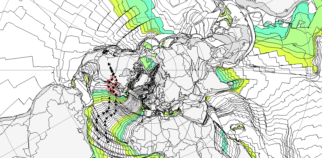
Scotese has treated the Beaufort Sea very differently, which we will explore. What is interesting in this view is the motion vectors for Colorado. The red coordinate markers are turned on only for the Superchron. During the Superchron Colorado moved initially southwest, but turned northeast. At the end of the Superchron, Colorado resumed the southwest vector that continues to the present. This can be seen more dramatically in the first image. Colorado’s change of direction at the end of the Superchron seems to correspond with the beginning of the modern spreading ridge perpendicular to the isochrons in the Beaufort Sea.
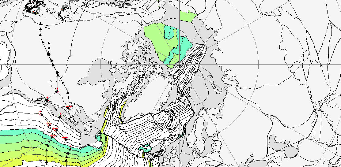
When we zoom in to the Arctic, we see that Scotese has the Superchron Beaufort/Arctic isochrons simplified to two periods. The darker green is 120mya and the lighter green 100. When compared with the Nachon isochrons below, it can be seen that Scotese ascribes a bilateral 120mya to an area left blank, and picks up a 100mya area on the continental shelf of Siberia.


Overlain for comparison, we see very significant differences. The general impression is that Scotese is trying to show Cretaceous extensional forces parallel to the modern ridge. The Nachon isochrons show Cretaceous extension perpendicular to the modern ridge in line with the Pacific ridge.
Nobody really knows what the North Pacific ridge system looked like 120mya. If the Nachon isochrons are correct, the Beaufort Sea may be a relict of what we now know as the Juan de Fuca ridge. The motion of North America can be explained by extension from this system as well, with waning spreading allowing a more northerly trajectory before the modern ridge from the Atlantic system pushed North America strongly southwest at the end of the Superchron.

Food for thought. Scotese Paleomap for 120mya at the beginning of the Superchron.


