
We have been doing a puzzle like you might have been given in first grade where there is some large animal with lines missing and your job is to connect the dots and fill it in.
The joy is still there, but as you will see the technique hasn’t improved much.

This is an image from the kml file for 60 mya based on work by Christopher Scotese. We decided to play a little game of “fill in the isochron”. The brightly colored areas are existing ocean floor with existing isochrons wee can drill and measure. The grey colors are continents as of 60 mya. The dark blue is windows into the Google Earth imagery where ocean floor has been lost. The white lines are our efforts of pure speculation, but we tried to match features suggested by remnants.
It seems to us that this represents the simplest possible reconstruction, and since it can reasonably be construed to fill the entire ocean basin, we feel no need for anything more complex. We were very surprised to follow existing ocean floor for more than half of the 80 mya isochron.
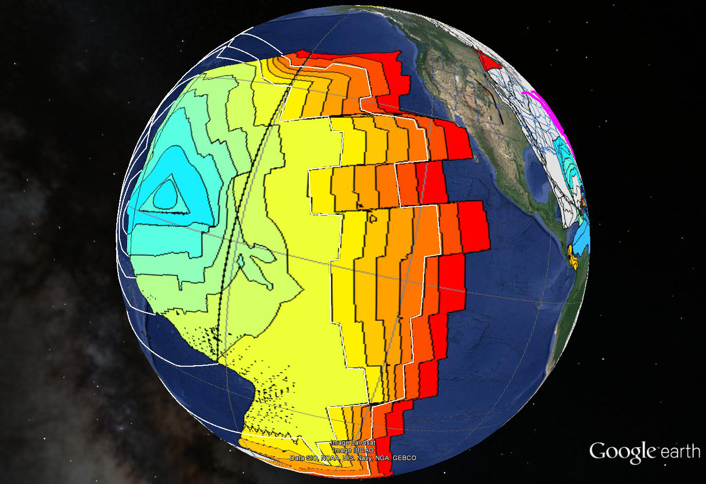
We have drawn our speculative white lines to bracket between the 120 and 80 mya existing isochrons because this was the long Cretaceous normal “superchron” when the planet felt no need to switch polarity for the longest time we are aware of. The spacing shown is nice and even because it is entirely interpolated and every bit as speculative as what we have done. We did not continue this interpolation and speculated only for the entire superchron.
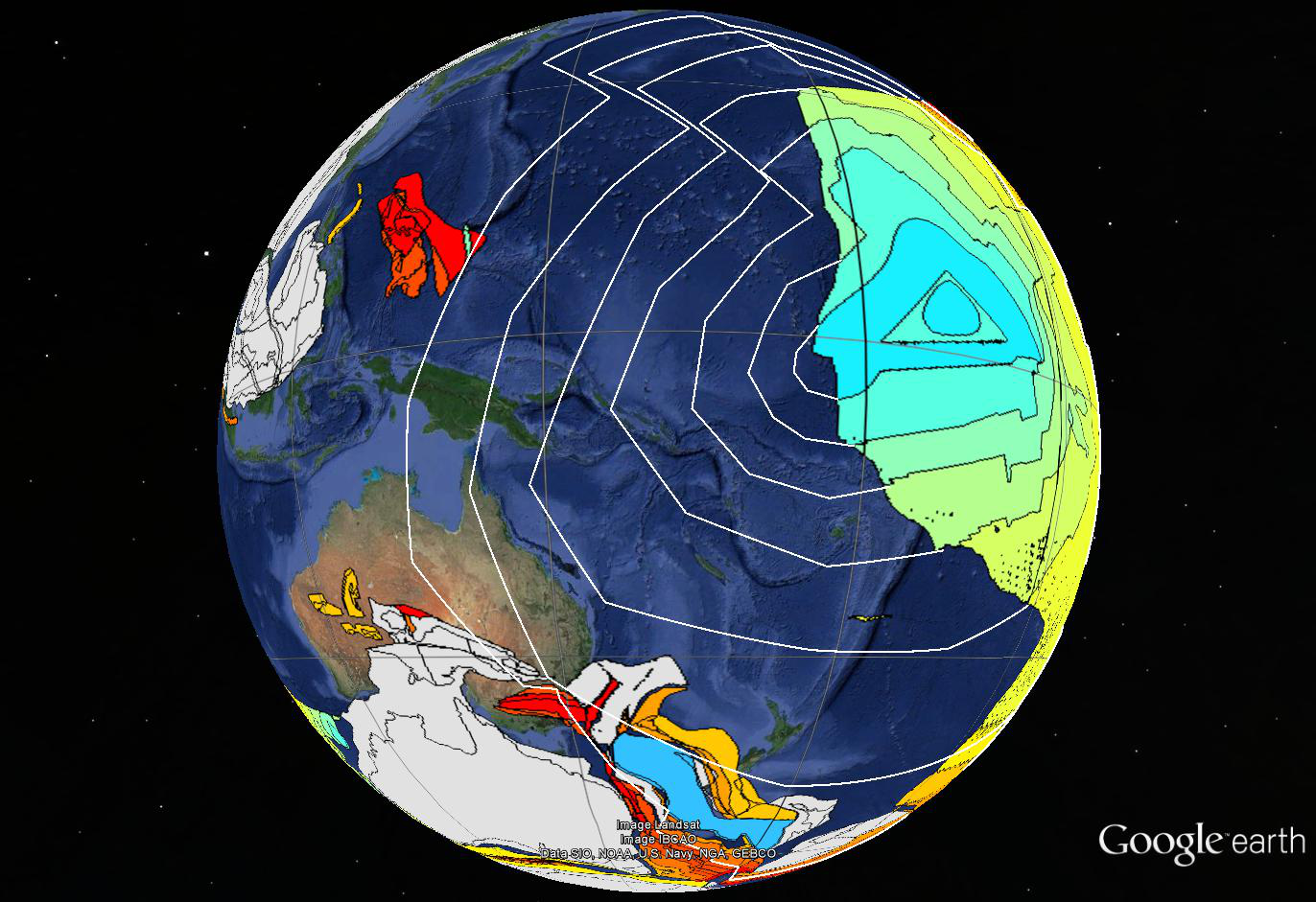
This is detail of our suggestions for the western Pacific. The continents are in their 60 mya positions. We stopped at the 80 mya isochron because other stuff seems to be going on, but with two more isochrons we could easily fill the basin.
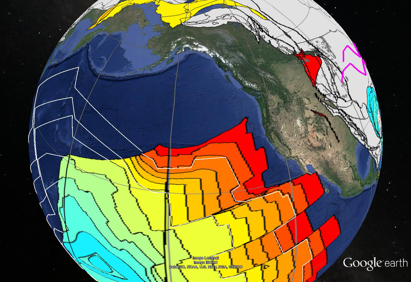
Some workers have posited a ridge between the red 60 mya floor and the red patch Scotese is suggesting in Washington and Oregon. The purpose of this ridge was to define and push a hypothetical plate named Kula as a vehicle for carrying various exotic terranes to their proper docking points. While there is room for such a plate and it cannot be excluded, any direct evidence for it has been subducted.
We feel very comfortable that the tectonic history of the Pacific Ocean floor can be adequately explained by concentric growth from a single point and its early expression as a triangle. We have suggested that the point could have been an impact. It could also possibly be thought of as an extremely large igneous province with an attitude.
Either way, existing seafloor records a ring half way around the world eighty million years ago. We have supplied the rest.


