
You simply can’t deny rock. Kick it and it throbs your toe. They lie around us, largely ignored, Farmers curse them and pile them in walls, yet a few dedicated folks with pointed hammers have picked them to yield an incredible window into the past of our planet.
Here we endeavor to place existing surface rocks into proposed paleogeographic contexts as spatial method for evaluation.
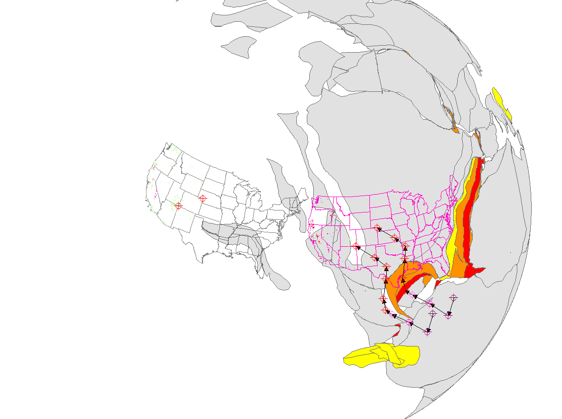
This is our world 160 million years ago as those who measure the paleomagnetism of rocks would have it. The positions of the continents and new ocean floor are based on work by Christopher Scotese. The current position of the US and all existing surface Jurassic rocks can be seen to the left. The Wrangell and Stikine terranes can be seen over the current US, supposedly migrating like whales to their current location in the crook of Alaska.
Thirty million years worth of the breakup of Pangea can be seen in the red/orange/yellow ocean floor opening in the Atlantic and Gulf of Mexico basins. The points and arrows indicate the sinuous wander path of Colorado since 250 mya for the coordinates of four corners and NE Colorado in 10 my increments. It is important to remember that the magnetic alignment of rocks during crystallization, adjusted for rocking of the boat, yields direct information only for latitude. Longitude can be constrained by certain statistical techniques and by the magnetization of existing ocean floor. The oldest shards of ocean floor can be found in the Mediterranean about 250 mya.
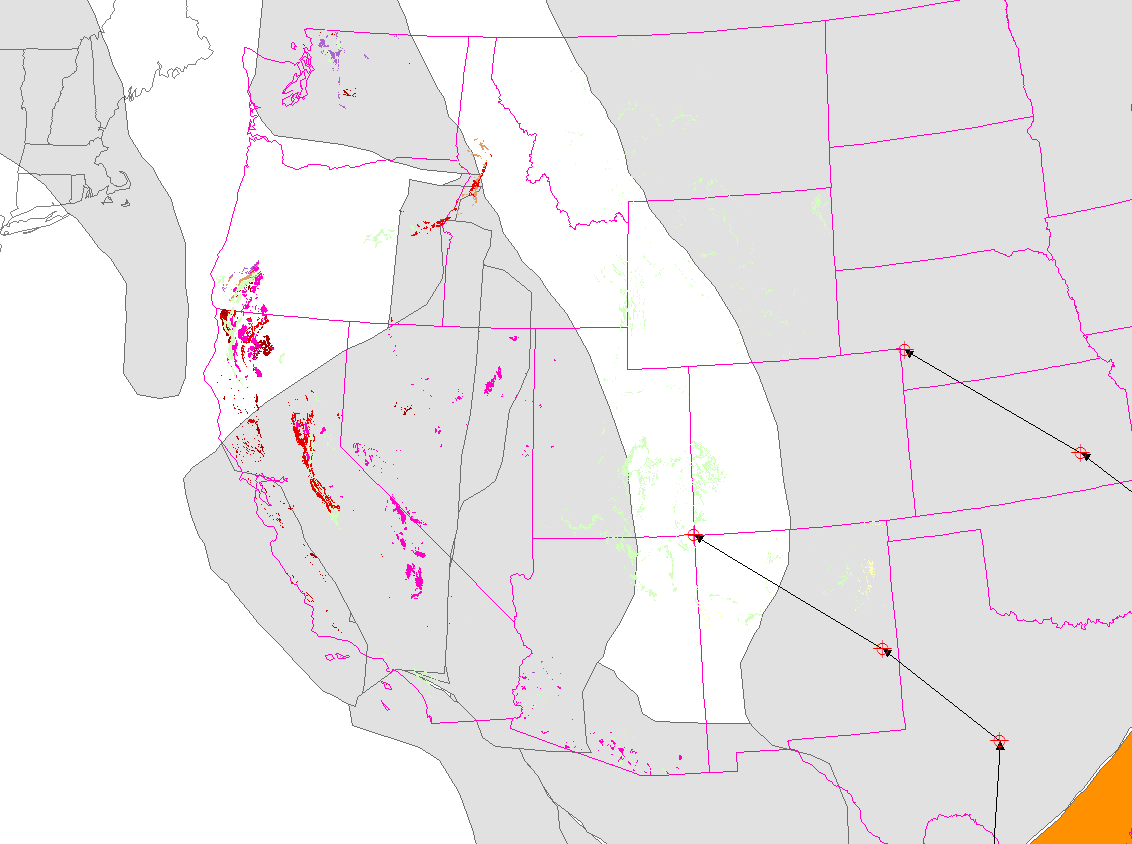
Here we zoomed in to detail of happening rocks 160 mya (spreadsheet available on request). The green rocks are marine sedimentary, yellow freshwater sedimentary, purple metamorphic, orange mafic volcanic, red general volcanic, and extra red felsic volcanic. Plutonic are magenta and chartreuse. Anyway, the rowdy colors are the hot stuff.
We can see that generally the green marine rocks are where they ought to be in the syncline seaway. It is difficult to justify the craton extending beyond the paleo margin of California, particularly as there are marine rocks in the San Gabriels and the Western Sierra province.
The position of the Stikine terrane makes little sense. Perhaps the Klamaths were further south a bit, but too much and they would interfere with Sierra plutonism. The Colorado vectors and the direction of the Pacific Ocean floor discussed here would have seemingly docked the terrane in the Columbia embayment.
It seems clear that existing surface rocks placed in their paleogeographic contexts argue for revision of current notions. They must be accounted for. If they moved, where? When? By what means?
Hard data.


