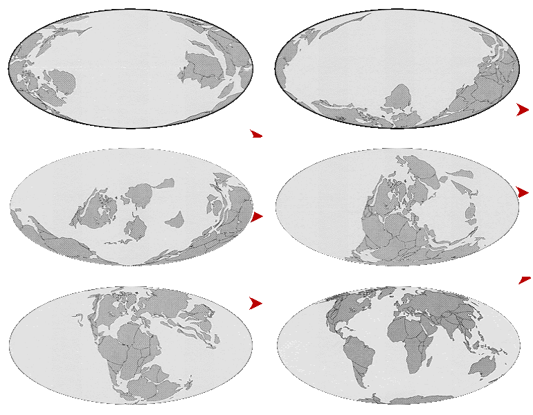
We have explored the Pacific Triangle and the Ring around Antarctica in prior posts. It just seems so outrageous that three spreading ridges would suddenly emerge from a single point in the Panthalassic Ocean 170 million years ago and begin migrating away in three directions.
Using base maps and paleocoordinate software developed by Christopher Scotese, we have been geolocating existing surface geology back in time. Our first effort has been the western U.S. and the current position of the States was held as a reference point and a launching platform for the transformations.
As we stepped through time, it became apparent that the Pacific Rise, having originated at the Triangle, was advancing on the current position of the U.S. from the west even as the true landmass was advancing on its current position from the east.
This Google Earth image shows how far the ridge had migrated from the Triangle and how much it had advanced on the current North America as of 60 million years ago(mya). It is important to remember that wherever you can see our current world in this image, there was only ocean floor 60 mya. We presume that the ridge was producing symmetrically so that there would have been a complimentary pattern of isochrons to the right (east) of the ridge, but all that ocean floor has been lost as has most of the floor west of the Triangle. There seems every indication from what little is preserved that the other two legs were producing as much floor and moving away at the same speed as the Pacific Rise.
We are going to offer here a hypothesis that the Pacific Triangle was an impact point and that the three spreading ridges represent, at least initially, a pressure wave in the mantle moving away from the impact point as the ripple in pond moves away from a rock thrown in. We offer this knowing that there is no notion of any impacts around 170 mya. There was a pretty decent extinction event and negative C isotope excursion at about 200 mya, but 30 my seems like a long wait, even for a postulated wave travelling less than a meter a year.
We are also aware that there are no known waves in the mantle that travel this slowly.
Here is the Antarctic view 60 mya.
You can see by comparing it to the identical current view that Antarctica has moved very little in the last 60 my and since there are no trenches, the ridges have necessarily moved away from it.
It seems that ridges are not fixed convective features, but rather are in constant motion. It can be seen from the wander path of the western U.S. that the westward movement is often much greater than the growth of the Atlantic ridge. What this means is that the fracturing Pangaea and the Atlantic ridge moved as a whole.
Maybe they’re all waves?


Pingback: Around the World in Eighty Million Years | geosciencebigpicture
Pingback: Rocks, The Origional Hard Data | geosciencebigpicture
Thanks for any other fantastic post. Where else may anybody
get that type of information in such an ideal method of writing?
I have a presentation subsequent week, and I am at the look for such information.
Thank you. I don’t know of any other sources. This is my own work and very speculative. The fashion these days is to work on speculations that can be mathematically modeled, as if this somehow makes the work less speculative…